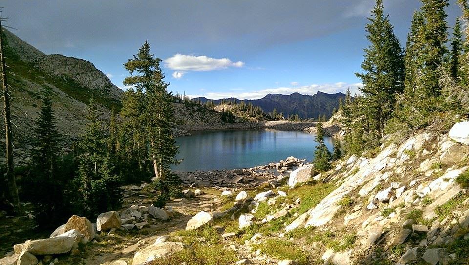
When I finally got to the lake there were 2 other pairs of hikers. Other than that though, the place is all yours. You can walk around the lake. If you go to the north end you can get some great lookouts to the mountains and trail. There's a little path if you go past the north end, that you can take just to see some other views. Go explore a little :)
By the time I got done with this hike it was a little over 10 miles. So be prepared. It can be steep at many parts, so walking poles might be useful for the trek down. There are some beautiful rushing streams along the way. You'll know the areas you can venture off the trail a little to check it out from above. There is one stream that was small when I was there, that you had to cross, but I'm sure more wet times of year it could get a little difficult to cross and keep your tootsies dry. Hiking in wet shoes for long durations is not ideal. I've learned that the hard way. Then learned again, and again, and….. :)
The trail gets warm and cold. Towards the top it was hot because there was no shade whatsoever. However, the rest of the drive is perfect with lots of beautiful. big trees.
I recommend this trail to those who have some endurance. It is one of the more difficult trails due to distance and steepness. The payoff isn't the best I've had, but it's still a great trail and worth the experience. Go hike it while you can, because soon enough it will be piled high with snow til next July. Be safe and enjoy the hike :)
My stats for the hike:
* 10.6 miles roundtrip
* 2,792 feet elevation gain
* 2 hour 58 min
* Advanced
* 1,247 calories (Take that gym!)
Internet stats:
* 9 miles roundtrip
* 2,540 elevation gain
* 9,980 ft elevation at lake
* 4.5 hours
* Difficult
 |
| From the bottom of the trail you can look across (on the other side of hwy.) to see view of mountains. I always try to look for the trail going up :) |
 |
| Small stream along trail. |
 |
| Follow the sign. Or else you might end up on another amazing trail. And we wouldn't want that to happen now would we? ;) |
 |
| View from close to the top. Less than a mile from lake. It can get very hot during this part of the trail. Switchbacks and no shade. |
 |
| The bigger stream along trail. |
 |
| Beautiful shot of lake from north end. |
 |
| I want to go to there. Oh wait…that's where I went :) |
 |
| View looking up before heading down to lake. I think this is Pfeifferhorn. Don't quote me on that though. |
 |
| Where the waterline at one point was. So sad to see the effects of the drought. |
 |
| The stream that could get not so great in wetter times of year. |
 |
| View to SLC from early in the hike. |
 |
| Saw these 3 on my way down. So many dear on the trails around here. |
 |
| The water was so clear. |
 |
| The money shot :) |
 |
| Little marmot. He just sat there and watched me watching him for several minutes. We had a nice chat :) |
 |
| More beautiful trail. |
 |
| Heading down the mountain. Those mountains were covered in fall colors. In person was beyond picturesque |
 |
| Can't get enough pics of the beauty of the trail. |
